The widespread impact of the ransomware attack on Garmin over the summer got me thinking about how important global navigation satellite systems (GNSS) have become. Once the sole purview of the U.S. military, access to global positioning data has now been embedded in myriad consumer products. It’s so common, we take it for granted. Can you imagine (or do you remember) having to drag out a big paper map for directions while driving? If we lost this capability, not only would ground, air and sea travel be more difficult, but the global logistics network we all rely on wouldn’t exist.
A GNSS consists of three segments: space (the satellites), master control (ground stations which monitor and program the satellites) and end user (a receiver or other device).
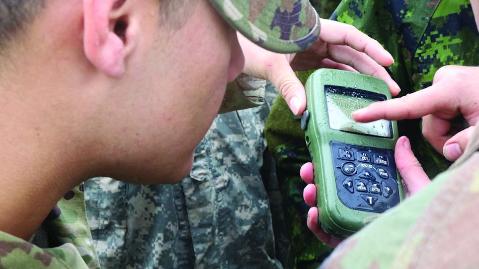
A GNSS doesn’t just provide accurate position data — it also provides location, velocity and time synchronization thanks to atomic clocks onboard the satellites. These satellites serve as beacons, like lighthouses, broadcasting one-way reference signals which are time- and position-coded. Your end-user device, or receiver, listens for the signal from several satellites and computes the difference in how long it was between when it was transmitted and when it is received. The more signals it receives, the more accurate the location computation. Generally, the receiver requires an unobstructed line of sight to at least four satellites. While receivers were once large backpack-sized devices, today, everything is contained in a small chip or run right in the software, allowing you to see live map tracking of your location on a wristwatch.
You probably call this satellite-based system “GPS” for global positioning system, but that is just one of four current GNSS in existence.
These other GNSS were developed by foreign nations because GPS is owned by the U.S. government, and the U.S. has turned off availability to certain countries in the past during times of conflict. What’s more, due to the system’s military value, foes have created systems to jam or spoof GPS, either denying access to the signals or providing false information. Regardless of the system, they all work essentially as described above.
The American NAVSTAR Global Positioning System is the first GNSS and was envisioned in the 1970s by the U.S. Department of Defense as a space-based system to provide precision navigation and timing data for personnel, vehicles and munitions. Beginning in 1978, the U.S. Air Force began to emplace the GPS constellation (consisting of 24 or more satellites) in orbit in space, with the system being declared fully operational in 1995. The satellites, which rotate the earth twice per day in one of six orbits, are replaced as needed with newer models and even more capability. A ground-based master control station monitors the constellation and uses various antennas located around the world to update the satellites. The current system ,which offers less than one meter accuracy to all users, is called GPS II. The GPS III upgrade should be completed by 2023. Almost everything you ever wanted to know about GPS is available at www.gps.gov.
Not to be outdone, the Soviet Union launched its own version of GPS called GLONASS for GLObal NAvigation Satellite System. Work began in 1976, with the first satellite going into orbit in 1982. It didn’t reach full global operational capability until 1995, and Russia initially allowed the system to degrade, but by the end of the century, it had commenced a system-wide upgrade that offers two-meter position accuracy.
Europe has the Galileo system, which initially became operational in 2016 and should have launched its last satellites around the time you read this. The reason it was created was so that European nations do not have to rely on GPS or GLONASS, which could be disabled or degraded by their operators at any time, since both were created for military use. Galileo offers two tiers of service: a lower precision version that is free to all with the appropriate receiver and a higher precision subscription service. Galileo promises horizontal and vertical position measurements within one meter precision and better positioning services at higher latitudes than other positioning systems. It also supports a new global search and rescue function as part of the Medium Earth Orbiting Search and Rescue system, which will eventually boast around 70 satellites. Finally, the system integrates with eCall, Europe’s version of 911. All major GNSS receiver chips support Galileo and hundreds of end-user devices are compatible with Galileo.
Most recently, the Chinese government announced that its version of a GNSS called BeiDou Navigation Satellite System (BDS), also known as COMPASS, has become fully operational. Since the late 1990s, the Chinese have used dual band receivers, which accept both GPS and GLONASS signals. The reason was that if they found themselves at war with either the U.S. or Russia, they could degrade one adversary’s system while relying on the other one. BeiDou consists of two different constellations and 30 satellites called BDS-3, which is used for applications ranging from high-precision positioning to short message communications.
Of note, Japan’s Quasi-Zenith Satellite System was designed to augment the U.S.-owned GPS with increased accuracy in Asia and Oceania, but it will offer its own GPS-independent navigation by 2023.
Often, manufacturers of end-user devices utilize both the GPS and GLONASS signals to improve accuracy and improve position accuracy in high latitudes (north or south). They also often now integrate Galileo signals, and before long, expect commercially available systems to also except the Chinese BDS signal.
Interestingly enough, many cell phones don’t rely on GPS at all to determine location. Instead of a space-based system that uses satellites, the cellular positioning system relies on cell towers for timing and location signals. In a similar fashion to GPS, your cellular device computes its location in relation to how long it takes for signals to arrive from cell towers, which have fixed locations.
It’s important to note that the Garmin ransomware issue was resolved pretty quickly and had nothing to do with the three types of GNSS signals they process: GPS, Galileo and GLONASS. Instead, hackers went after Garmin’s software and network infrastructure, which processes the signals. However, the incident only underpins the importance of selecting GNSS-enabled devices that receive and process more than a single signal in the unfortunate event one or more is degraded by natural or manmade phenomena.


